Friday, July 28, 2017– Orienteering in Central Park led by Sherry Felix for The Linnaean Society of New York

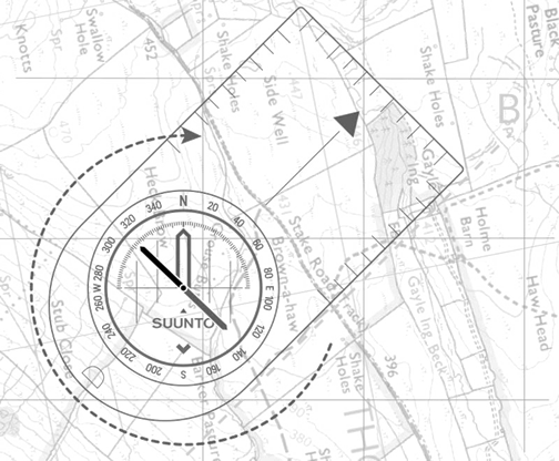
When you head into regions unknown in search of a special bird, you may think you can rely on your cell phone’s map and compass apps—but batteries die and GPS signals fade. This is why finding one’s way using a traditional compass and understanding how to read topographic maps is still vital. Join former urban park ranger and Audubon environmental educator Sherry Felix in the Ramble as she reviews map scales, symbols, and contours as well as basic compass bearings—plus a few ways to navigate without any aids at all.
If you can, bring a compass with a transparent plastic plate and download and print the Central-Park-Orienteering-map-2017
Meet at the northeast corner of 77th Street and Central Park West at 6:30 pm.
Most interesting. Wish I coud go!
LikeLike
It was on the 28th.
LikeLike
Sounds like a great class, Sherry–best wishes.
LikeLike
It was fun. I had one person.
LikeLiked by 1 person
I’d love to join you, if it was possible, Sherry. 🙂 🙂
LikeLike
Thanks
LikeLiked by 1 person
Sounds an interesting orientation to get to know the park and its animal residents! You are a perfect speaker for this subject! Congrats and best wishes for the orientation!
Somehow your post reminds me of my experience at the Central Park and reading the map in cell phone. I remember I was lost in direction and in the end I had to take a pedicab. Surprisingly the driver was a newcomer to NYC and he was as clueless as I was. But well, in the end we had good time in exploring the park in funny way 😀
LikeLiked by 1 person
I am only covering orienteering. No wildlife this time.
That’s a funny story. Thanks for dropping by.
LikeLike